A watershed is a land area that channels rainfall and snowmelt to creeks, streams, and rivers, and eventually to collection points such as reservoirs, bays, and the ocean. Also referred to as a drainage basin or catchment, a watershed can be described on many scales depending on the collection point being discussed.
Watersheds have a few defining components. First, precipitation is the source of the water contained within a watershed by the continuous ridgeline, or watershed divide, that separates the catchment area of the watershed frpm adjacent watersheds. The stream network within the catchment area moves water downslope and also interacts with water contained within the groundwater aquifer. Last, there is an outlet which connects the watershed to a receiving body of water, perhaps a larger stream, a lake, or the ocean.
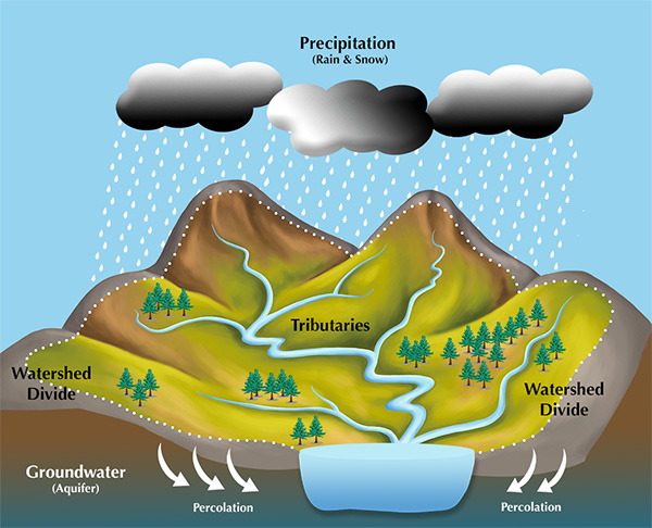
Source: Kim Roberts, Center for Watershed Protection
The watershed for a drinking water reservoir would include all the land that contributes overland flow by streams and simple surface flow to the reservoir and can have a significant affect on water quality if that land is not managed well. The drainage area for Shawnee Lake in Bedford County is about 36.5 square miles, for Raystown Lake the watershed is 958 square miles, for the Chesapeake Bay the watershed is over 64,000 square miles, and the Mississippi River delivers to the Gulf of Mexico water collected from a watershed of 1.15 million square miles, stretching from the Rockies to the Appalachians.
Watersheds of the Commonwealth
Six Ways To The Sea (or is it 8 ways?)
Pennsylvania's total area is 46,055 square miles with 44,816 square miles of land surface and 1,239 square miles of water surface. Flowing water that leaves Pennsylvania eventually enters either the Atlantic Ocean or the Gulf of Mexico. The map below illustrates the river basins that collect water from the catchments in Pennsylvania and route this flow to these two destinations. Briefly discussed will be the path that each river travels but the focus will turn to the two (or three) river basins that Bedford County streams flow towards.
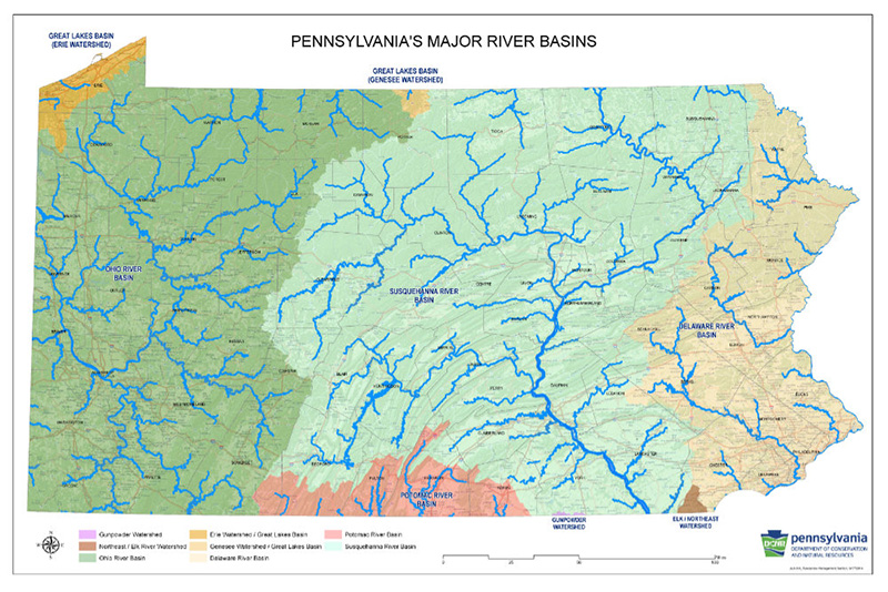
Click on the map above to open a new Acrobat page with larger map image at higher resolution.
The route to the Gulf of Mexico is by way of the Ohio River that flows west from the confluence at the Point in Pittsburgh and joins the Mississippi River at Cairo, Illinois. The confluence at the point is the juncture of the Allegheny and Monongahela Rivers that together drain much of western Pennsylvania as well as portions of New York, Maryland, and West Virginia. (First Way to the Sea)
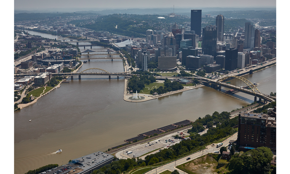
At the Point in Pittsburgh, the Allegheny River (upper left) joins the Monangahela River (right) to form the Ohio River (lower Left)
Pennsylvania waters join the Atlantic by several routes. In Erie County. a number of streams flow north into Lake Erie and these waters flow north to tumble over the falls at Niagara and into Lake Ontario where they mingle with some other Commonwealth waters that have travelled north from near Ulysses in Potter County by way of the Genesee River to Rochester, New York. All these waters flow northeast from Lake Ontario toward the Gulf of St. Lawrence, via the St. Lawrence River, and into the Atlantic. The Lake Erie basin in Pennsylvania is 511 square miles with Conneaut Creek, Elk Creek and Walnut Creek among the larger streams. The Genesee River basin in Pennsylvania is 199 square miles. The river is 157 miles long with just 11 miles in the Commonwealth. (Second and Third Ways to the Sea)
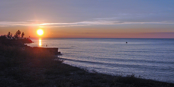
Pennsylvania's Lake Erie Coast
The eastern border of Pennsylvania is largely formed by the Delaware River but for an odd cut-out defined by a circular arc defining most of the border between Pennsylvania and Delaware. Draining an area of 13,539 square miles, the Delaware River is 330 miles long. Flowing into the Delaware Bay estuary, these waters join the Atlantic between Cape May, New Jersey and Cape Henlopen, Delaware. (Fourth Way to the Sea)
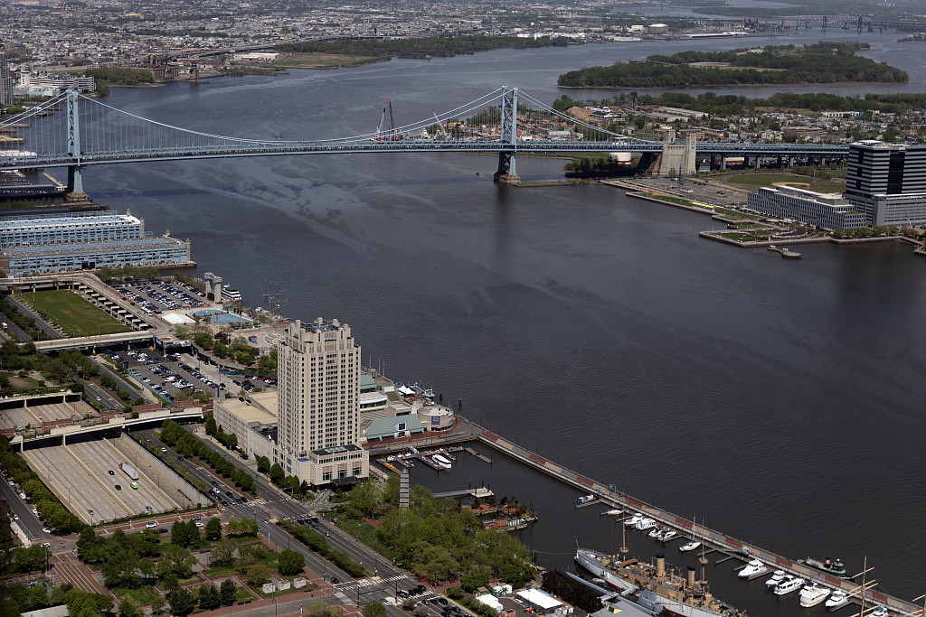
Delaware River at Philadelphia - Penn's Landing in foreground, Benjamin Franklin Bridge in background. Image - Library of Congress
Along the southern border of Pennsylvania, water flows to the Chesapeake Bay by way of a number of creeks that drain southern parts of Somerset, Bedford, Fulton, Franklin and Adams Counties as headwaters to the Potomac River. In Bedford County, Wills Creek and Evitts Creek flow to the North Branch of the Potomac, while Town Creek, Fifteenmile Creek and Sideling Hill Creek join the main stem of the Potomac farther east. The Potomac River is the second largest contributor of freshwater to the Bay draining an area of 14,670 square miles in PA, WV, MD and VA, with just 1584 square miles of the watershed in Pennsylvania. (Fifth Way to the Sea)
The Susquehanna River is the Bay's largest tributary, accounting for about half of the freshwater flow into the Chesapeake, and about 90% of the freshwater flow in the upper Bay (north of the Bay Bridge). The Susquehanna River begins at the outlet of Otsego Lake at Cooperstown, NY. Some consider the river between the source and the junction with the West Branch of the Susquehanna near Sunbury, PA, as the main stem Susquehanna while others called this section the North Branch. The West Branch begins in northern Cambria County and flows in a generally easterly direction past Lock Haven and Williamsport to meet the main stem.
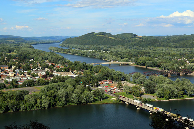
The image above was taken from the Shikellamy Overlook in Shikellamy State Park and shows the North Branch (or main stem) of the Susquehanna flowing southwesterly to meet the West Branch which is flowing left to right in the foreground of the photo. The main stem Susquehanna River would be off the right edge of image. The developed area to the left in the photo is Northumberland and Sunbury is on the far bank of the main Susquehanna out of the picture to the right. Photo by PA Department of Conservation and Natural Resources
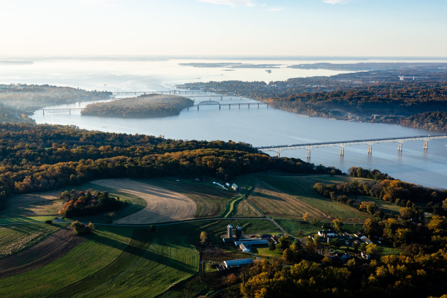
The above photo from the Chesapeake Bay Program shows the mouth of the Susquehanna entering the Chesapeake Bay looking south. The island in the the river near the mouth is Garrett Island. The four bridges visible in this photo are the Millard E. Tydings Memorial Bridge at near right center carrying Interstate 95, the CSX Susquehanna River Railroad Bridge and the Thomas J. Hatem Memorial Bridge carrying US 40 both spanning Garrett Island, and the Amtrak Susquehanna River Rail Bridge south of the island. Havre de Grace, Maryland, is on the point of land on the right-hand shore just past the distant bridges.